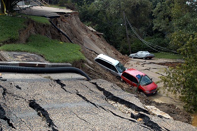
A new system has been created by the Geological Survey of Bangladesh and the Geotechnical Institute of Norway.
The Geological Survey of Bangladesh (GSB) and the Geotechnical Institute of Norway have come together to create a new mobile technology based system that has been designed to forecast landslides.
A new forecast machine issues a signal to cell phones to alert users of an increased risk of landslides.
This new mobile technology alert system has already been implemented in a number of hilly areas and it has deemed to be successful. Heavy rainfall can cause both loose rocks and soil to absorb a considerable amount of water. As this continues the pressure from this absorption increases in the soil and rocks. Finally, the pull of gravity and the rising pressure causes the ground to crack and the soil and rocks to become dislodge, beginning a landslide. As the landslide progresses down the incline, it can pick up a great deal of additional material and force and it presents a massive threat to anyone or anything that is in its way.
The new forecast machine sends alerts through mobile technology based on several weather and geological factors.
 The machine calculates the risk based on overall statistics of the amount of rainfall, the types of soil, and the length of time that the rain has been falling. The GSB entered into this partnership in order to be able to create a system of alert and prevention in response to the 2007 landslide in Chittagong, which killed 127 people.
The first testing of the forecast machine was conducted in 2010, and the data produced through that testing was the foundation of a research paper on the technology that was published by Springer in 2012 and presented at the World Landslide Conference in China.
The study revealed that if there is 100 mm of rainfall within a span of three consecutive hours, there is a striking increase in the landslide risk within hilly landscapes. Moreover, the risk also increases when 200 mm of rainfall occurs within a 24 hour period, or when 350 mm falls within 72 hours. The data is recorded into a computer which conducts an analysis of the risk and sends that information to a server which then alerts the applicable officials and designated mobile technology devices so that timely action can be taken to bring threatened residents to safety.

